


M56 Junction 2: Altrincham, Wythenshawe
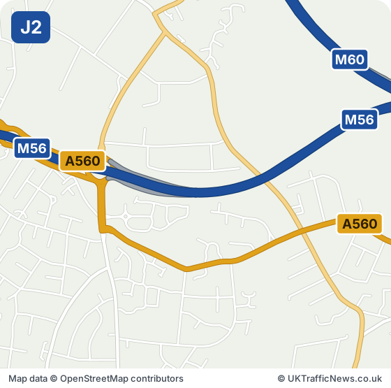
M56 J2 — Is the Sharston Interchange. Junction 2 of the M56 is the Sharston Interchange, with Sharston being a heavy industrial area to the north of the M56 and Wythenshawe residential area to the south of Junction 2.
The A560, B5166 and B5168 all touch the junction, and the local road names include Altrincham Road, Longley Lane and Sharston Road. Northenden and Benchill are close neighbours.
Brookway Retail Park lies about two miles west, Spire Manchester Hospital about two miles north, and East Didsbury station roughly a mile and a half north-east. Kingsway Interchange and Junction 3 are each under a mile away.
Check this junction now: live M56 speed flow map · latest M56 traffic news · M56 trends
Collisions near junction 2: the police recorded 1 injury collision on the M56 within about 2.5 km of this junction in 2024 and 2025 (1 serious). These are the police-reported figures published by the Department for Transport (STATS19).
- Junction M56 J2
- Signed for A560 · Altrincham, Wythenshawe
- Next junction westbound J3, 1.0 miles
- Next junction eastbound J1, 0.7 miles
Live traffic at M56 junction 2
The speed strip below shows the M56 from junction 1 to junction 4, both directions, from National Highways’ live data, checked every five minutes.
Live traffic speed flow: M56 Junctions 1 to 4
Untick all three to see just the speeds. We show the important overhead signs and the mandatory speed limits (red ring); see every overhead sign.
Go to our live M56 traffic speed flow map ›
NOTE: The speed flow, overhead sign messages or other information shown on our live traffic speed flow map is updated every few minutes. We cross check the data and aim to provide warnings if there could be a delay or an inaccurate speed reading. There can be occasions, beyond our control, and despite our best efforts where the speed flow could be inaccurate. We cannot therefore guarantee the speed you can expect on any stretch of the motorway is always accurately shown. However we hope you will find our live traffic speed flow map a useful tool in trying to plan your journey. Safe driving.
All the latest M56 traffic news →Live M56 traffic flow map →
Around M56 Junction 2: Towns and Places on the Map
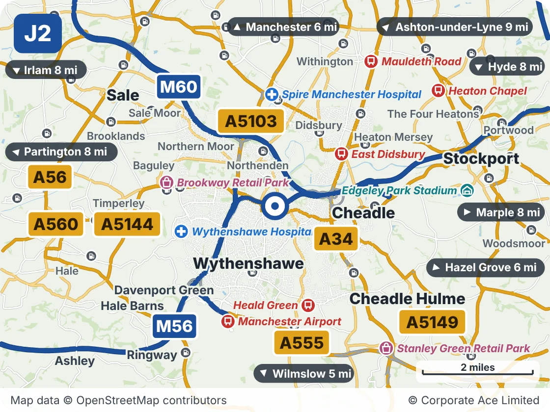
| Place | What it is | From the junction |
|---|---|---|
| East Didsbury | Railway station | About 1.5 miles north-east |
| Wythenshawe Hospital | Hospital | About 2 miles west |
| Heald Green | Railway station | About 2 miles south |
| Brookway Retail Park | Shopping | About 2 miles west |
| Spire Manchester Hospital | Hospital | About 2 miles north |
| Manchester Airport | Railway station | About 2.5 miles south |
| Mauldeth Road | Railway station | About 3 miles north-east |
| Stanley Green Retail Park | Shopping | About 3.5 miles south-east |
Junctions either side
Live traffic news at M56 Junction 2
This is the news for Junction 2 only, not the whole M56. For the rest of the motorway see all the latest M56 traffic news, the overhead signs and the speed limits in force now.
Updated 02:17 (2:17am) Thu 22 Oct 2026